Posts Tagged With: ruins

A Funny Thing Happened on the Way to the Forum

If you draw a Great Circle route — or just about any sane route — between Baltimore and Oslo, it will not take you through Rome. And yet here we are for three nights, since OAT offered it as a low-cost add-on to the Scandinavian main event. We even capitalized on our exalted station in life to fly Business Class to get here, primarily because Alice said so. So here she is nestled in her airborne Lap O’ Luxury pod, aboard our British Airways 787. (They are arranged like love seats with the two occupants facing each other, antiparallel so that the configuration looks like a letter S as viewed from above. The gap between them has a frosted window that can be raised and lowered if you’re tired of looking at each other. The screen at left swivels out 90o to face me.)

Masks are no longer required on flights, but we fall squarely into the “better safe than sorry” demographic, which put us into a surprisingly small minority. During our plane change at London Heathrow, we were struck by the relative paucity of masks in the airport; I’d estimate that fewer than 10% of people were using them. So apparently COVID is no longer anything to worry about, and all those nagging epidemiologists not worth listening to. Who knew?

We arrived on time in Rome and were promptly met by our transfer driver, whose only role was to (a) walk us and our luggage to his car, and (b) drive us to our hotel, but nearly managed to blow it anyway. (“You had one job!“) The meeting part went fine, the walking to the car part not so much. He walked fast, way fast, pulling ahead of us like a speed walker on crack. Alice could not keep up, to the point that I had to fast-walk ahead, literally grab him, and tell him to slow down. He nodded, though apparently in recognition that it was Backwards Day, since he then charged ahead as though pursued by wolves, down the corridor, around a corner, and into thin air. He lost us. Alice stayed at the point of our last confirmed sighting of him while I executed a one-man search party mission, hunting around as many corridors and parking lots as I could find, and periodically returning to Alice to see if he had noticed we were gone and retraced his steps, which apparently he had not.

After 15 minutes of this, my phone started to light up with texts, photos, and GPS pins from him trying to tell us where he was. The photos were useless since we didn’t know the landmarks, and the GPS pin did not suffice to guide me since we were at a low level in the building and my phone couldn’t get a GPS lock. Then my phone started to light up with unhelpful messages from his office, telling me that he was there (where?) and we should go find him. (Thanks, I hadn’t thought of that!) Finally after about a half hour of misadventure we found each other, and our ride to the hotel was enlivened by a long telephone conversation between him and the office, characterized by the calm analytical reasonableness for which Italians are famous.

Ha! Didn’t fool you, did I? Of course they screamed at each other over the phone for the entire time, a high-volume pyroclastic flow of Italian imprecations whose only comprehensible words to us were “Whatsapp”, “GPS”, and “photo”.

No matter. The important thing is that we are in Rome, which vies with Tokyo for the title of Major City With the Highest Density of Cheerfully Crazy People. We’ve been here before and love it (especially the food), and we only have two full days so we are not going to do the high-sped tourism, see-everything schtick. Today was the Coliseum and the Forum, tomorrow the Pantheon, the Borghese Museum, and tomorrow night a Vespa tour of the city where we ride in motorcycle sidecars. (We did something similar in Vietnam three years and had a blast.) That’s about it.

The weather is sunny and quite hot — around 90F — which is noticeably debilitating for Alice. But she gamely made it through our 3 hour walking tour of the Coliseum and the Forum. We booked an official guide, a young, lanky, voluble PhD archaeologist named Eddy, in order to be able to get to the underground parts of the Coliseum where not everyone is allowed to go. You all know what the Coliseum looks so here’s the obligatory outside view (a 2-shot panorama, for the photographers among you):

(The column on the left does not really lean outward; that’s an illusion due to the perspective and the geometry of the panorama.) Here’s a gallery of interior shots that you can click on for a larger image.

And now the moment you’ve been waiting for, namely an array of Fun Facts about the Coliseum:

  • It was completed in 80 AD and originally sported a gigantic statue of Nero modeled after the Colossus of Rhodes, hence the name.
  • It could hold roughly 70,000 spectators, who enjoyed gladiator fights, public executions, and other family fare, which reminds me…
  • The whole “thumbs up, thumbs down” image of the emperor condemning a gladiator is complete bullshit, originating mostly from an otherwise obscure 19th century French painting that shows the crowd doing it. In fact most gladiator deaths were accidents, since the matches were frequently fixed in advance: the two managers would cut a backroom deal about who would win or lose, with the emperor as a witness. In fact, a gladiator would sometimes be “killed” in a match, only to show up again in a later match as a different character (with different costume and helmet to obscure his face). In short, the whole industry was rather similar to professional wrestling today.
  • The gladiators did not look like Russell Crowe. They lived on a low-cost high-carb, low-protein diet and mostly were pretty flabby.
  • The place had 66 elevators to bring animals and sets and such up from the underground corridors to the level of the arena. One or two have been restored, elaborate mechanisms operated by about eight slaves. The last slave in the operating sequence was the guy who opened the gate to let the animal out into the arena. Those animals were starved for two days before their appearance, so you did not want to be that guy. Speaking of which….
  • The word “arena” comes from the Latin word for “sand”, which coated the floor and was used liberally for sopping up blood.

The Forum is a short walk from the Coliseum, immediately below the Palatine Hill. That’s the hill upon which Rome was founded, in historical legend. You remember Romulus and Remus, raised by a she-wolf after their mother abandoned them by floating them in a basket down the Tiber River. (If that sounds suspiciously like Moses, bear in mind that the latter predates Rome by a solid millennium, so that paradigm was already well-established.) In any case, Romulus killed Remus in the most epic case of sibling rivalry since Cain and Abel, and went on to found the city on the first of what became the Seven Hills of Rome. Which is especially intriguing in light of the inconvenient geographical fact that Rome actually has nine hills. But seven is a more mystically powerful number (the Seven Seas, Seven Sisters of the Pleiades, seven dwarves, etc., etc.) so I guess someone did some creative cartography. In any case, Palatine Hill, by virtue of both its views and its historic provenance, became the go-to neighborhood of Rome and the site of many elaborate homes…. and that’s where we get the English word “palace”. (Ta da!)

Today, Palatine Hill is a smattering of (to me) not especially interesting ruins, scattered among various empty spaces accompanied by signage explaining what used to be there. But just below, the Forum is more engaging, in part because the buildings there reflect its diversity as the town square where pretty much everything was going on: government buildings, religious structures, markets, plazas where performances took place. The latter included minor league gladiator bouts; because it was so expensive and elaborate to configure and operate, the Coliseum only hosted major events about 10 times a year. This panorama gives you an idea of the variety of Forum activity.

Some of the colonnades are shrines to assorted gods, such as this one in honor of Vesta, the Roman goddess of hearth and home. She was a big deal, so much so that she was still actively worshipped for centuries after Christianity had taken hold. Her priestesses — they were all women — were pledged to chastity (you have heard the phrase “Vestal virgin”), the penalty for deflowerment being buried alive.

The good news, such as it was, was that you could start training to become a Vestal virgin at the age of six (!), and were only obliged to stay in service for 30 years. After that, at age 36, you were free to sow your wild oats, and good luck with that because at that point you were already 20+ years beyond being considered marriageable.

And then there was the pontifex maximus, the senior Roman religious official of the day. He had offices in the forum and, it is said, a secret tunnel to the Vestal shrine where the virgins hung out so he could, um, protect them. Which we can all agree sounds both very ancient Roman and very modern at the same time.

We just returned from a rooftop diner at our hotel, looking out over the city. I’m sufficiently non-exhausted that I am about to venture out for some nighttime photos of the Spanish Steps, which are only a few blocks from our hotel. I will post the photos in a few days.

Categories: Europe, Italy | Tags: , , , , , , , , , , , , , , , , , | 1 Comment

My Son

Actually I have two sons, both exceptionally fine human beings whom I love and am proud of beyond words.  But this post is not about either of them. In fact, it is not about anybody’s son. It’s about a place called Mỹ Sơn, written with all those accent marks that make Vietnamese a special kind of nightmare. I just left the accent marks out of the title so I could have a moderately clever opening line. (And at some point down the line I am going to write a post about the Vietnamese language, which is an utter beast.)

Mỹ Sơn is a UNESCO World Heritage Site, a complex of temples and other buildings created between the 4th and 14th centuries by the Champa people, whom you have very likely never heard of. It’s considered to be one of the longest inhabited archaeological sites in Indochina, comparable in appearance to Angkor Wat in Cambodia, and Ayutthaya in Thailand.  We spent yesterday morning and early afternoon there; it’s about an hour’s drive from Hoi An.

My Son IMG_8408-Pano

My Son IMG_8417-HDR

My Son IMG_8377

My Son IMG_8388-HDR

Naturally, this being such an important site, the US bombed the bejeezus out of it during the war. Much of it was destroyed, and the path among the ruins is pockmarked by 50 year old overgrown bomb craters, perhaps 30 feet wide and still 8-10 feet deep.

My Son IMG_8394

The Champa people were an extensive and aggressive group who were a big deal in central and southern Vietnam from about the 2nd century AD for a good thousand years or so. They were Hindu, not Buddhist, in particular venerating Shiva, part of the Hindu trinity that includes Vishnu and Brahma. In keeping with the whole yin-yang paradigm, and oversimplifying by about 2 billion light years, Vishnu is female, the creator, symbolized by the yoni (representing the female genitalia); Shiva is male, the destroyer, symbolized by the lingam (representing the male genitalia). There are stylized versions of each scattered throughout the complex; here is a yoni:

My Son IMG_8423 If your lingam persists for more than 400 years, consult your doctor.

There is a path that meanders among the ruins, a number of which have armless, headless statues of Shiva in and around them. The arm- and headlessness of the statues are one of the many gifts of later Western occupiers, notably the French.

My Son IMG_8393

You will note from all of the above photos that the structures are made almost entriely out of brick. That is pretty remarkable in itself: it is very difficult to make bricks that will last for ~1500 years in this hot, wet climate. In fact, it is so difficult that no one knows how the Champa did it. The composition of the bricks is well known through various assay techniques, but the manufacturing process is still a mystery. Replacement bricks have been made as part of a partial site restoration process; you can see Phil pointing out some of the new bricks in the photo below. But these will not have anything like the longevity of the original structure.

My Son IMG_8392

At about the halfway point of the path through the complex, we came to a small open area that is used for a folk music performance, using traditional instruments as we have sen before, and dancers as well. They played for about 10 minutes and we continued on our way.

My Son IMG_8397

My Son IMG_8402

If you look carefully, you can see that the elaborate headdress worn by the dancer in red in the middle has a burning candle on top. Here’s a better view.

My Son IMG_8404

We continued along the path, which looped back to the starting point. There was a pavilion there where we saw yet another performance, this time more directly tied to the Champa and having a distinctly more Hindu flavor, albeit a little sexed-up for the tourists, e.g.:

My Son IMG_8435

By this time we were dance-performanced-out and, in keeping with our typical day here, drenched with sweat. So we retreated back to our hotel, Alice to get a massage (which costs about one-third here of what it does back home,) and me to take advantage of one of the hotel infinity pools.

Categories: Vietnam | Tags: , , , , , , , , , , , , , , , , , , , | 1 Comment

All the Way to Hué

The dynast Nguyen Anh – he after whom nearly 50 million Nguyens are currently named — unified Vietnam in 1802, as I mentioned earlier, and the question arose as to whether he would keep the capital in Hanoi. One of the first foreign emissaries to present his credentials to Nguyen was the Mexican ambassador, Jose Valdes Bolano, who posed that very question. Nguyen famously replied, “No, Hué, Jose.”

(OK, I invented that conversation just to go for the cheap pun. If you don’t like it, go write your own damn blog.)

(Does it help if I tell you that the current Mexican ambassador to Vietnam is a woman named Sara Valdes Bolano? I didn’t think so.)

Nguyen did in fact make Hué the capital in 1802, and it remained such until the French showed up and started knocking over the furniture in 1945. It’s our first stop in what used to be South Vietnam, i.e. the part of the country south of the 17th parallel that defined the infamous DMZ. The contrast with Hanoi is striking, a legacy of the  contrasting paths of economic development that the North and the South took prior to the unification in 1975 when Saigon finally fell to the Communists. Hué has a population of less than 400,000, about one-twentieth the size of Hanoi, and yet has the feel of a fully developed Western city: a glitzy downtown with lots of neon and a thumping bar scene; lots of English language signage and stores that would be at home in any American mall; and (slightly) less random traffic. It’s an attractive town, threaded by the placid and scenic Huong (“Perfume”) River.

The historical centerpiece of Hué is the Imperial City, a.k.a. the Citadel, whose planning was begun by Nguyen around the time he took over. It sits near the river, facing southeast for both feng shui and political reasons, which is to say that it faces away from Beijing. In its heyday it was an enormous thriving complex, dominated by a fort with cannons but, very much like the Forbidden City in Beijing, containing over 150 buildings containing the residences of the royal family and their retinue, attendants, and hangers-on. It’s surrounded by a moat — formerly populated by crocodiles, per our tour lead Phil — nearly 10 km long.

Hue IMG_7616-HDR

The Citadel started to fall on hard times when the Viet Minh (the forerunners of the Viet Cong) occupied it in 1947, and was pretty much devastated during the Tet Offensive in 1968 when both sides variously occupied or bombed the living hell out of it. There are only about 10 buildings left today. Fifty years later, the destruction is still a source of hard feelings among the families and descendants of the antagonists. It has been designated a UNESCO World Heritage site and is the subject of a fair amount of restoration. Much of what’s there is beautiful but it still contains a lot of overgrown fields.

Hue IMG_7643-Pano-HDR

Hue IMG_7683

Hue IMG_7673-HDR

In keeping with a very Buddhist yin-yang, war-piece paradigm, we traded the Citadel for a nunnery, in this case a nearby small Buddhist nunnery housing ten nuns ranging in age from 16 to 73. Our guide was a 24 year old nun who had been there since the age of 16; she spoke no English (Phil interpreted) but served us a typically wonderful lunch — vegetarian this time — and answered our questions. You are well aware that male Buddhist monks shave their heads but it may never have occurred to you that the nuns do as well, though this is frequently hidden by their headpieces. It makes some of them surprisingly androgynous.  Our guide spends long days running errands, chanting, and going to college in town. She comes from a poor family — not uncommon among nuns and monks — and traveled a few hundred miles to be here.

Hue IMG_7724

Religion, of course, is kind of a no-no in Communist countries, but the authorities here have lightened up a lot and about 20% of the population is observant of one or another religion, the most common (about 11% of the total population) being Buddhism as you would suppose. But there are others, perhaps the most oddball being Cao Dai (sometimes written Caodaism), which is a Bahai-like amalgam of all sorts of sorta-monotheistic stuff. It was founded right here in Vietnam in 1926 and claims something between 2 and 6 million adherents, almost all of them here. (If the higher number is accurate, there are as many Cao Dai followers in Vietnam as Jews in the US. No reports on whether they can find a decent corned beef sandwich.) Caodaists believe that the word of God has been revealed repeatedly through the writings of Earthbound prophets, whose numbers include Sun Yat Sen and — go figure this one — Victor Hugo. I mean, I know that Les Miz was a big hit, but c’mon.

I mention all this because we visited a Cao Dai temple, which I am happy to report was as loonball colorfully crazy as you would expect from a religion that encourages you to communicate with two of the their other revered figures — Joan of Arc and Vladimir Lenin — via seance. (If they ever adopt Tom Wolfe and Hunter Thompson, I’m converting.)

Hue IMG_7749

Our next religious experience was a somber one. Overseas Adventure Travel is part of the Grand Circle Foundation, a nonprofit that supports about 100 various social projects (schools, orphanages, etc.) in some 59 countries. They’ve given out something like $200 million, and a small part of each OAT trip cost is sent to them. Each such trip — and this is our sixth with OAT — includes a visit to a Grand Circle project, which yesterday was the Duc Son orphanage. Grand Circle has a provided computers, lockers, beds, sewing machines, and other stuff; we brought along gifts of school supplies. (Click on the thumbnails for the full size images.)

The orphanage houses 135 children, which is not exactly the right word since some stay into adulthood. The youngest are infants, and most have been abandoned. The place is run, heroically (there is no other word) by only 12 nuns. There used to be 18, but burnout is a real problem because the work is literally non-stop. The older kids help take care of the younger, which is the only way that such a place is even remotely workable. We were very, very impressed: the staff is nothing short of superhuman, and it shows in the kids’ behavior, which was raucous, cheerful, well-organized, and… normal. The kids receive Buddhist religious instruction, but not very extensively; although the staff are all strict vegetarians, they prepare and serve the kids non-vegetarian food in order to avoid any nutritional or developmental risks. That’s a big leap out the staff’s spiritual comfort zone and is one of the many measures of their extreme commitment. (The kids do get two “vegetarian days” per month, however.)

Of the 135 charges, 16 are handicapped in some way (we saw one Downs infant, being played with by a rambunctious non-handicapped boy of about 3). The orphanage receives gratis twice-weekly visit from a nearby doctor, another critical lifeline that makes the institution manageable, but only just. We left the place awed at the nuns.

Our final outing of the day (yes, this all happened yesterday) was a musical interlude. The Perfume River is home to a large number of touristy “dragon boats”, basically raft-like dual-hull houseboats decorated with dragon heads on the front.

Hue IMG_7798

In this case Phil had chartered the boat and the owner family had brought aboard an ensemble Vietnamese folk musicians, who played some traditional stringed instruments, one of which appeared to be a Japanese 16-stringed koto. The other three were variously banjo- or violin-like, though each had only one or two strings. Here they are in action:

Note the gal who’s using teacups as castanets! They played and sang for about a half hour whilst we lay at anchor in the middle of the Perfume River. And when they finished they lit some candles in paper containers folded into lotus shapes, and one by one we set them adrift in the river…..

Hue IMG_7816

Hue IMG_7827


Categories: Vietnam | Tags: , , , , , , , , , , , , , , , , , , , , , , , , , , , , , , , , , , , , | 1 Comment

Hapuna a me ka Lapakahi

…which is not as complicated as it looks. It simply means “Hapuna and Lapakahi” in Hawaii, those being the names of two places on the Big Island that we visited yesterday.

Hapuna Beach is one of the best known beaches on the island, an achingly photogenic stretch of dun-colored sand caressed by a gentle turquoise surf, and framed by two jagged lava promontories at either end. Here’s a panorama from the drone, taken during yesterday’s visit:

Hapuna Beach drone-001

Besides the obvious beach and surf, there are two other features of note: Kohala mountain bulging gently above the horizon at left, and the luxurious Hapuna Prince Beach Hotel at far left, regally overlooking the scene. The hotel is enormous and beautiful; several years ago we had the privilege of staying there for four or five days on someone else’s dime while attending a boondoggle conference. The mountain is also enormous: a mile-high, 200 square mile (500 square km) extinct volcano that essentially is the entire northwest corner of the Big Island.

Conditions are not always this idyllic at Hapuna. The surf can be rough, although the bottom is sandy — unlike the other, rockier beaches on the island — and so a rough surf is far less dangerous than elsewhere. And if the wind is high you can get sandblasted whilst attempting to enjoy yourself. But these are the exceptions. Most frequently the place looks like a postcard and it is a popular destination for sunning and body surfing. Here’s a 2-minute drone flyover video to give you a sense of the place:

(As you can tell, I’ve gotten heavily into flying my drone on this trip. But I dare you to tell me that this is not seriously cool.)

Neither Alice nor I are sunbather types. For one thing, when I am in strong sunlight my mottled pasty complexion moves the state of my skin almost instantly from “Anemic Vampire” to “Crimson Crispy”. In the words of Woody Allen, “I don’t tan, I stroke.” And Alice grew up in Oregon, where one’s best opportunity to get a tan requires dodging the raindrops. So we hung out for 45 or minutes or so with our visiting friends, then moved on.

Our next stop, further up the coast in Kohala, was a little more cerebral: Lapakahi State Historical Park. It’s the ruins of an ancient coastal village, about 600 years old. The name means “single ridge” and it is an array of ruins and reconstructed structures spread out along a rough lava coast and threaded by a mile-long interpretive trail. Like so many archaelogical sites it seems to make the most sense when viewed from above, so here are a couple of aerial shots:

Lapakahi drone-002Lapakahi drone-001

In addition to the ruins, the offshore area is a Marine Life Conservation District. The interpretive path takes you past a variety of structures in various stages of deterioration or, in some cases, reconstruction. There are dwellings, canoe storage houses, salt-making pans, and a couple of kōnane games, the latter being a lot like Chinese checkers. It’s played on a lava “board” with a grid of hollowed out pits, with alternating black and white stones placed in the pits and variously moved around per the rules.

The aerial views give you a sense of the layout of the place, but, truth to tell, when you are following the path it mostly feels like you are walking among a random collection of low lava walls of uncertain purpose. Which, I suppose, is why I am not an archaeologist. Nonetheless, the place has an enjoyably eldritch feel to it, the susurration of the surf and the dark rough lava walls invoking a real sense of mystery and age. Or to put it another way, it feels just a bit like being inside the beautiful old computer game Myst. Here’s a video that I took by flying along the coast, so that you can see how large and spread out it is.

The surf has been high and the weather on the windward (eastern) side of the island rainy for the past few days, so we have confined our roamings to the Kona coast and the western side of Kohala to escape it. But things look better for the next few days. Tomorrow we will try and make it to the 13,802′ (4205 m) summit of Mauna Kea where the conditions are expected to be clear, provided one is willing to tolerate sub-freezing temperatures and 20 mph winds. They’ve had a lot of snow up there this winter, so if we are lucky then I will have some “snow in Hawaii” photos to post.


Categories: Hawaii | Tags: , , , , , , , , , , , , , , , , , , , , , | 2 Comments

Come with Me to the Casbah (Again)

As we suspected, our Rabat city tour today included a return to the Oudaya, i.e. the casbah whose Andalusian gardens we visited on our own yesterday. No matter. But before I get into all that I wanted to post a couple of photos from last night. The shipboard restaurant — appropriately enough called Le Dhow — is permanently moored on the Bor Regreb river that runs through Rabat, and although we did not see a large amount of boat traffic (despite the fleet of blue fishing boats that we never saw move) there is nonetheless a lot of activity on and in the river. People swim, people dive (for what?), people kite surf. And along the banks, people stroll, sell stuff, hang around, and — if you’re about 5 years old — drive around in little tiny electric cars:

Does this look like fun, or what?

And here is the restaurant itself, a few hours later:

Le restaurant s’appelle Le Dhow

Which brings us back to this morning. Our first stop was the Royal Palace. Now, I have already told you that many cities host Royal palaces should King Mohammed VI decide to drop by. But Rabat, being the actual capital, is home to the Royal Royal Palace, a sprawling 100 acre compound that, oddly, is accessible to foreign tourists but not to native Moroccans. Once through the gate, our bus heads down a long straight road flanked mostly by broad manicured expanses of grass; the are several buildings in the compound but they spread far apart from one another, giving the whole area the look of a particular nice suburban tract that is still waiting for some upscale real estate developer to build either a shopping mall or townhouses.

The palace itself looks like nothing so much as an exceptionally large community recreation center, so unremarkable in architecture that I never even tried to take a photo or panorama of it. So for your edification I stole one from Google Images instead. Here is the Royal Community Recreat Palace:

The Senior Center is around the back.

As you might be able to tell from the image, the only interesting part is the main doorway, which is tiled in a colorful pattern. It is also guarded by a number of impressively-uniformed people with guns, and we were only allowed to approach within about 100 feet or so.  The guards are drawn from all branches of the military, everyone wanting a piece of the prestigious action, and so the groups of guards look like this:

If they’re called uniforms, why are they all different?

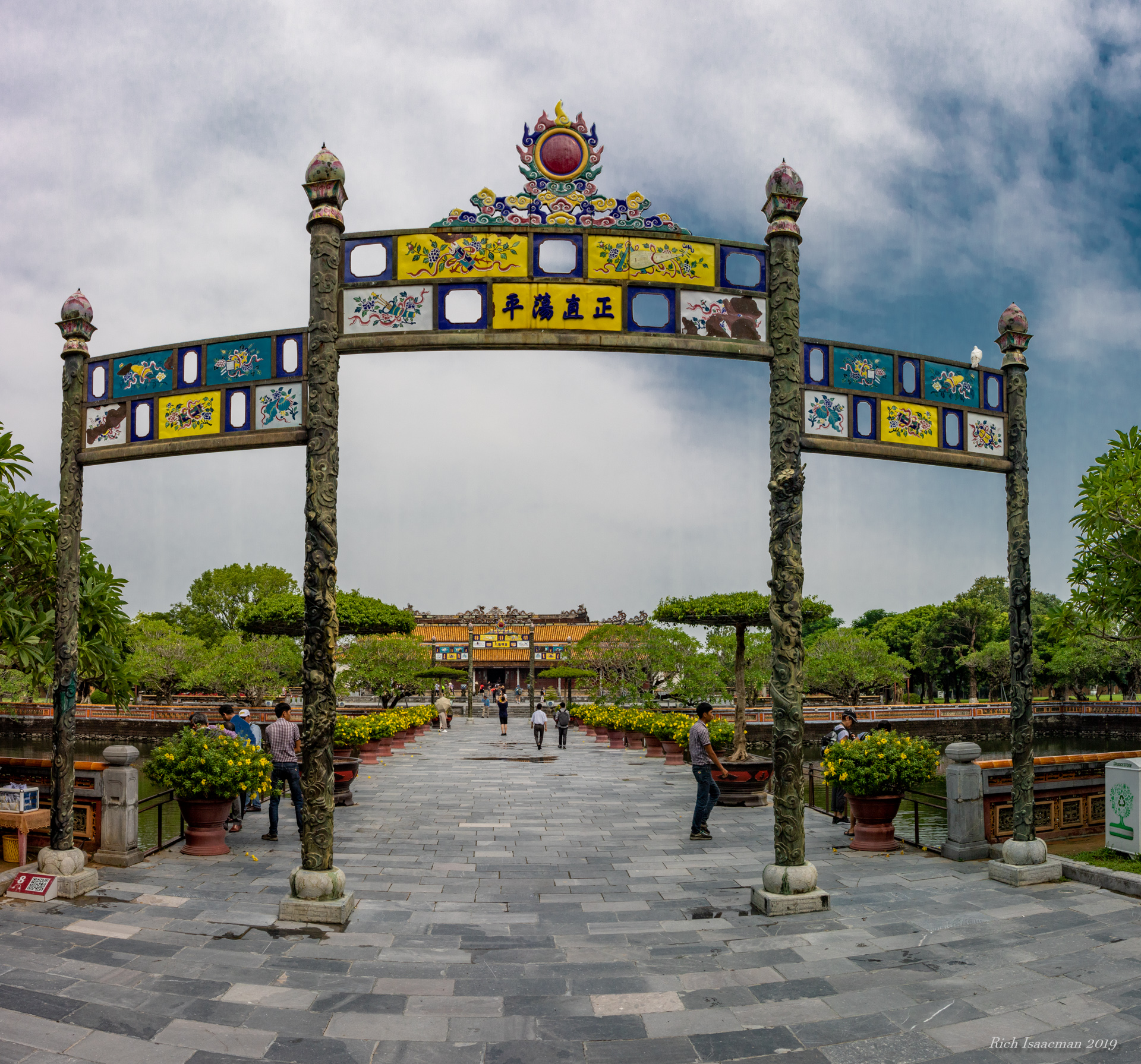
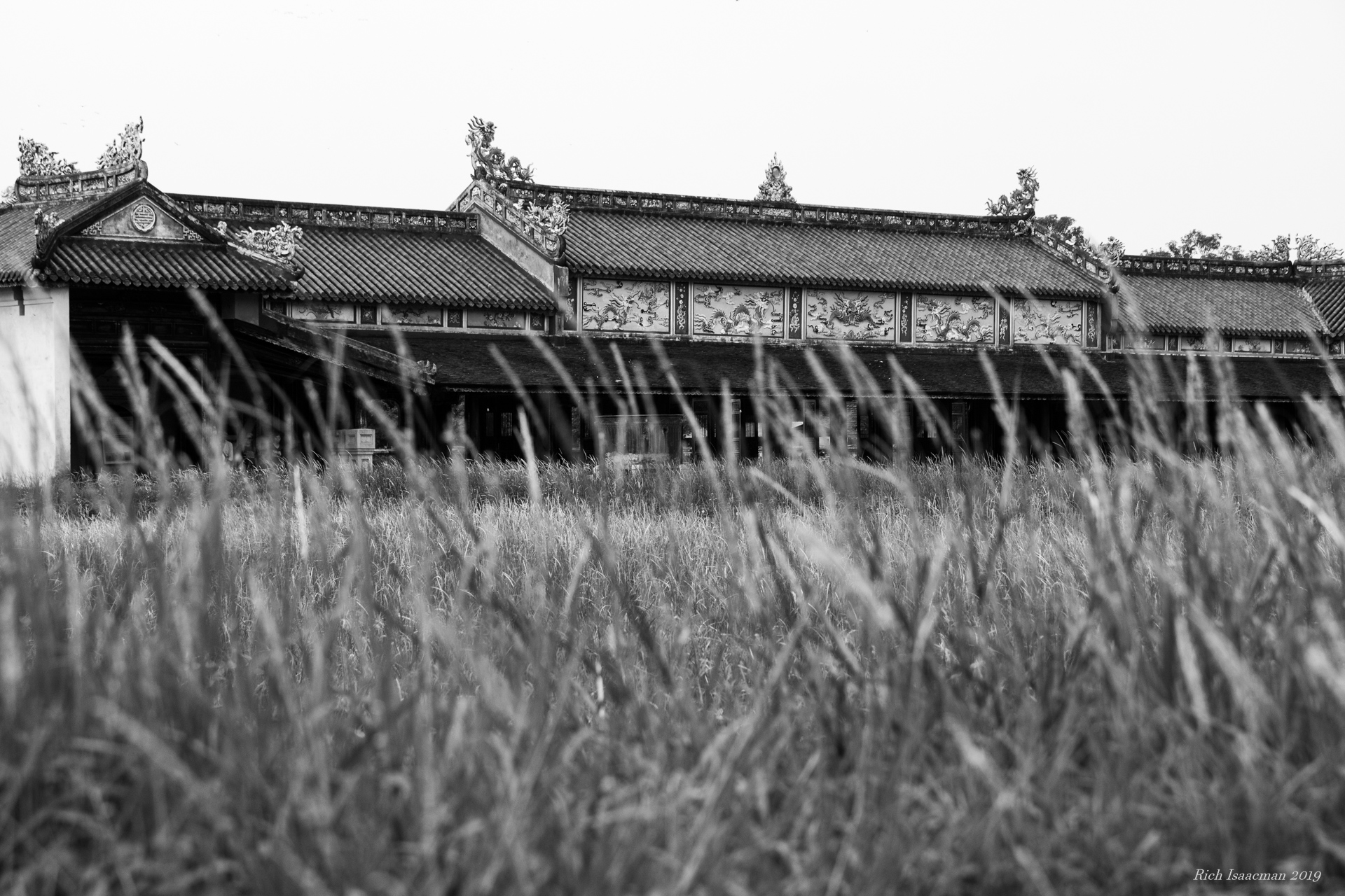
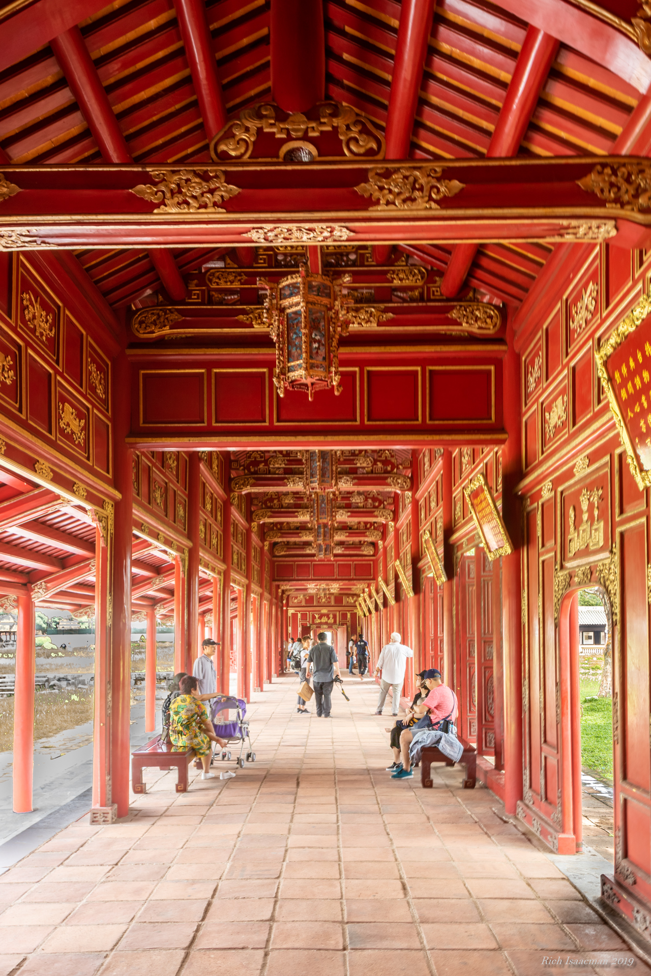
Interestingly, this is the only place in the country where one is allowed to photograph soldiers and policemen, so I took advantage of that permission via telephoto. The guy on the right in the white pajamas and red belt is an actual palace guard, separate from any of the service branches.

And that was it, as far as the Royal Palace went. We were not allowed inside any of the buildings, so the drive past the huge lawns, and a view of the front door from 100 feet away, was the extent of our experience. It was a little unsatisfying, a case of palace interruptus. (Honesty and a fear of people bigger than myself compel me to confess that Steve gave me that one.)

Our next stop was an ancient Roman necropolis dating from about the 4th century BC. It has been variously rep riposted and updated over the centuries and from the outside looks much like the casbah itself, a sandstone-colored walled city. Two panhandling musicians greeted us at the entrance. You can see one here. He was a drummer.

Once inside the walls, the grounds themselves are ruins, mostly collapsed walls and columns. Many are tagged and the is some kind of surveying operation going on, perhaps a prelude to some reconstruction. One of the more unusual features is a dark, shallow pool, lined with granite blocks, to which antiquity has ascribed restorative properties. In particular, it is supposed to restore fecundity to women who are having trouble conceiving; and to add a big, heaping dose of Freudian symbolism to this particular juju, there are a number of eels swimming in it.

Up until today our tour lead Momo has been dressed in Western garb, usually a casual short sleeve shirt and slacks. He went native today, however, wearing a djellaba that, somehow, seems to suit him better. So here he is at the necropolis:


Our next stop is known as the Unfinished Mosque, because it is, well, unfinished. A 140′ sandstone tower (half its intended height), the mosque was begun in the late 12th century by Sultan Yacub al-Mansour and was intended to be the biggest, best, etc., etc. But he died in 1199, and the succeeding powers have up on the project. It sits today at one end of an enormous square, hundreds of yards on a side, filled with a grid of half-ruined columns ranging up to about 15′ in height, as though they are all paying observance to the tower. 

Now at this point in the narrative, those of you who have been following this blog for a few years might observe, “Hey Rich and Alice, you’re always complaining that whenever you travel somewhere the historical structures are covered in scaffolding! But that hasn’t happened on this trip!” Yeah, about that. Guess which 140′ ancient World Heritage structure was covered in scaffolding?

Fortunately, a beautiful structure that was not covered in scaffolding sat at the other end of the square, namely the tomb of King Mohammed V, grandfather of the current king. Here are some shots showing the exterior and interior of the tomb, as well as one of the colorful guards.

Look Ma, no scaffolding!


We are not amused.

Our penultimate stop of the day was the Oudaya casbah, where as I already wrote about the four of us had spent a pleasant afternoon yesterday. Now part of the larger group, covered a lot less ground today than the four of us did yesterday, so I have not got much to add. Here, then, are a few photos of the place.

Exterior courtyard, with kids playing soccer


Some local ladies enjoying the Andalusian garden


Making bread in dark and cramped quarters on a side street

I mentioned yesterday that there was a large cemetery adjacent to the casbah, on a hillside overlooking the river. Turns out that it’s a pretty exclusive place: you have to be rich and/or powerful to be buried there, in addition to being dead. The burial custom is that the corpse is interred laying on his/her right side, facing Mecca. Here is a small section of the cemetery.

Merely being dead will not get you in here.

We ended the afternoon at the Mohammed VI Museum of Modern Art. This was quite the departure from just about everything else we’ve seen, being as contemporary as can be. A lot of the art here would be right at home in MOMA in New York City, or in Baltimore’s Visionary Art Museum. And a lot of it would be right at home in a landfill, too. But the building was modern and airy, all glass and steel and open space, with an Isalmic ambience:

And here is a modern wife in silhouette on the main staircase:

We didn’t last terribly long there, but the museum was only two blocks from our hotel so it was an easy walk back. Dinner this evening was at a local traditional Moroccan restaurant called Dar Rbatia (that is not a typo) in the heart of the souk. We had to navigate through a crush of humanity this time, not just crowded streets but packed ones, complete with chanting, blaring music, and a generous supply of pickpockets. It was straight out of a movie, hard to capture in still photos. But I shot a few minutes of video as we pushed throug the street, camera held over my head and drawing a fair number if remonstrances from some of the people; Moroccans do not like having their picture taken. It was quite the experience, and I will post the video after we return home. And dinner was outstanding, with about four traditional courses. If you’re ever in Rabat, go there. 

The drive back to the hotel was interrupted by some excitement, as we encountered the tail end of a wedding party out on the street, complete with bedecked bride and groom. The bride was feeling expansive and invited us to come and take pictures, but the rather less gregarious groom had other ideas. So, no pictures. Can this marriage be saved?

Tomorrow we move on to Fez, stopping en route to see the a roman ruins of Volubilis…and also to meet Momo’s wife!

Categories: Africa, Morocco | Tags: , , , , , , , , , , , , | Leave a comment

Vaporetto to the Ghetto, and Moving on from Venice

Venice-etal-1We had grand plans for Sunday the 19th involving Venice’s Jewish Ghetto, but we overslept and, though we ended up walking arund the ghetto and visiting the Jewish Museum, we had some time constraints that prevented us from taking the tour of the ghetto’s five synagogues. (Photo taken in the staircase inside the museum.)

Venice’s Jewish ghetto has the dubious distinction of being the original Jewish Ghetto. The Jewish population was isolated in 1516 by order of the Doge (it was either that or leave the city altogether), and they were moved to an undesirable area near the edge of the city at the site of a foundry. The Italian word for “foundry” is geto, pronounced like “jetto”, but later German immigrants pronounced it with a hard G since the German language has no soft G. And so the modern word was born.  It’s a remarkably small space, basically a single square with two narrow streets radiating off it. Two of the synagogues are located on the square and the other three on the side streets.

Although World War II-era Pope Pius XII has come in for considerable criticism for what many see as a laissez faire attitude towards the Nazis, Italy did better than most occupied countries when it came to protecting their Jews. They managed to ship off almost none at all until 1943, when Germany invaded and occupied northern Italy after Mussolini figured out who was actually going to win the war and switched sides. It was in late 1943 that the deportations started: 8000 Jews were shipped off to concentration camps, and eight came back. Even so, 80% of Italy’s Jewish population survived the war.

Today, despite the presence of several kosher restaurants, the ghetto is home to approximately zero Jews and — but for the synagogues themselves — is more tourist destination than religious enclave. We toured the museum, and as we were about to leave the square I passed a young (about 30 years old) Hasid — beard, flat hat, black coat, the whole deal — who bade me “shalom“. So I “shalomed” back, and we fell into conversation. He said, “Are you Jewish?” I replied, “Yes, and I’m guessing that you are too.” He was Australian, visiting Italy for a month including the recent Passover holiday. So I said, “chag samayach” (“happy holiday” in Hebrew, to my Gentile readers), at which moment I became a marked man. He spent the next several minutes trying to inveigle me into accompanying him to the synagogue to don the tefillin, which are the leather phylacteries worn by orthodox Jews, and it’s all very complicated so just click the damn link on the word “tefillin” to get the full explanation. Suffice it to say that I had not done this since I was 13 years old and was not about to do it now, because (a) I had absolutely no memory of the required prayers; and (b) also had no memory of the appropriate details for winding the leather straps and would in all likelihood have ended up strangling myself. It would not have been a salutary experience for either of us, so I begged off.

Our traveling companions Jim and Elaine arrived from Trieste that afternoon (hence our time constraint); we had flown over with them but they started their sojourn in that city and we were now meeting up again to spend the next 2 1/2 weeks together. Our first joint stop was the Peggy Guggenheim museum. The heiress was quite the force in the art world in the 1940’s — a major patron and collector — and amassed a large collection of contemporary art here in Venice. Salvador Dali, Jackson Pollack, all the biggies form that era. Her grave is on the grounds of the museum, rather oddly surrounded by the graves of her 14 “babies”. One is shocked that she had so many children — all of whom died — until a closer reading of the headstone reveals that (a) they all died between the ages of 5 and 14, and (b) they all had names like “Sir Herbert” and “King Kong”, “Peacock”, and “Cappucino”. Dogs. Lhasa apsos, to be exact. Sheesh.

The weather had improved considerably over the chilly rain we had had the previous two days; the day was sunny though the night was still brisk. It seemed like a good opportunity to take the vaporetto around to St. Mark’s Square to watch the crowd and get some night shots, e.g.:

Venice-etal-3 Venice-etal-2

One of the curiosities of St. Mark’s is the “dueling orchestras”. Several of the restaurants around the square have rather formal looking outdoor quartets playing both classical music and classical-sounding versions of popular tunes from various eras, e.g., Sinatra’s “My Way”. It is a pleasantly anachronistic sight. Here’s one of them:

Venice-etal-4

We spent yesterday (Monday April 20) on a boat outing to Venice’s two most popular nearby islands: Murano and Burano. Murano is famous for its glass factories and galleries, but to our eyes seems to be largely coasting on its reputation. Virtually every store along its canals is a glass gallery, and they seem to fall into two broad categories: crap made in China, and genuinely beautiful incredibly expensive locally-made pieces.  Many of the latter have signs in front of the store that say “No China” so you ostensibly know that you’re getting the real deal. But since our choice seemed to come down to lousy stuff or stuff we couldn’t afford, we didn’t buy anything.

Venice-etal-6

It should be called “Floating French Fries”, but it isn’t.

A few of the stores have resident artisans whom you can watch making glass items on the spot. This was fun to watch. What was not so much fun was when I tried to take a picture of said artisan and got yelled at. “No photos!”  Jeez.  Bunch of glass-holes.

There is an interesting  museum on Murano that displays glass items from the full history of glass, from the earliest Mesopotamian pieces of about 1000 BC to hypermodern art installations like the one I photographed here. The museum was certainly the high point of Murano, but in truth it was no better and in some ways less interesting the Corning Glass Museum in upstate New York. In short, if you’re pressed for time in Venice, you can pretty safely leave Murano off your list.

Our next boat stop was the neighboring island of Burano, very small and known primarily — and for very good reason — for its colorful streets and for its lace industry. We didn’t buy any lace but the houses are insanely photogenic. Here are a few photos from various streets and alleys; the last one is the main canal and shops.

Venice-etal-10 Venice-etal-9 Venice-etal-8 Venice-etal-7 Venice-etal-5

Burano also has its own leaning tower, a bell tower at tilts at about a 5 degree angle, roughly the same as its more famous cousin in Pisa. But it’s hard to get a good close vantage point that allows the tilt to show up in photos; you see it best from far away, aboard the boat.

This was our last day in Venice, and hence our last opportunity for a gondola ride. Yes, it’s touristy, and yes, it may be overpriced, but c’mon, how jaded do you have to be to go to Venice for the first time and not ride in a gondola? We are experienced travelers, not jaded ones, and so after appropriate due diligence (i.e., reading some web sites to see how much it ought ot cost, how long a typical ride is, etc., we took the plunge (not literally). In case you were wondering, a “standard” ride costs 80 euros and lasts for roughly a half hour. More if you want to go longer, or if you go at night, or if you want the guy — and they are all guys, every one — to sing. The basic package was entirely adequate for our purposes. (And by the way, if you do want to the guy to sing, do not ask for “O Sole Mio”. That’s a Neapolitan song: wrong part of the country.)

Fun facts, courtesy of our gondolier Antonio: there are 500 gondoliers in Venice, all men, and many having come to the career through the family line (Antonio himself claimed to be 5th generation). They all know each other; we saw that in action since we encountered several other gondolas in some of the side canals, and the guys all chatted continuously among themselves. You have to go to Gondolier’s School to get certified. (And you damn well better study; the clearance on some of the tighter turns in the side canals was about an inch.) A gondola is 35′ long, weighs about 1200 lbs, and has six coats of paint. The Rialto Bridge restoration will take two more years. Et cetera. It was quite a lot of fun, and of course very romantic. We were satisfied, as the second of the next two pictures shows.

Venice-etal-12 Venice-etal-13

And that was the end of our stay in Venice. This morning we picked up our rental car (a brand spanking new Peugeot 5008 that fits us and our luggage perfectly) and set off for Aquileia, about 60 miles to the north, a formerly-great port city during the waning days of the Roman Empire. There is little there now except for a smattering of Roman ruins and, much more impressively, a basilica whose floor is a very old Roman mosaic. Here’s a detail:

Venice-etal-15

We walked around for a while then struck out for tonight’s lodging, a B&B in the northern foothills, a gorgeous wine region whose hillsides look like, well, exactly what you think they should. I’ll try and get some photos tomorrow. We are staying at a 4-unit lodge built from what appears to be a converted farmhouse overlooking a vineyard. It’s a beautiful place in a rustic hilltop village. In fact, the only thing exciting our cynical instincts is the name of the village, which is San Pietro del Fellete, which we of course call St. Peter of Fellatio. No jokes about “thy rod and they staff”, please.

OK, if I’m writing stuff like that it must be late and I must be exhausted. So I will stop now.

Categories: Italy | Tags: , , , , , , , , , , , , , , , , , , , , , , , | 6 Comments

Create a free website or blog at WordPress.com.